A beautiful day with amazing views – well worth the detour around Blea Tarn at the beginning of the walk – definitely a walk to do again!
WAINWRIGHT BOOK: The Southern Fells Book 4
DIFFICULTY: 2 WALK LENGTH: Half a day
DATE and START TIME: Thursday 18th August 2016 – Start time 9.50am
PARKING: Blea Tarn National Trust car park, Langdale, Cumbria, UK. (NY295 043)
ROUTE WALKED: (OS map OL6) – Blea Tarn – Side Pike – LINGMOOR FELL (BROWN HOW) – and back down again – a circular route.
WALK DETAILS: 3.5 miles, a leisurely 3hrs 40mins. including lunch and coffee breaks.
HIGHEST POINT: Lingmoor Fell – 469m/1539ft.
WALKED WITH: Pal and Mila (aged 13).
WEATHER: Coolish to start getting hot on top and rather hazy.
The plan today is to walk around Blea Tarn then to walk up Side Pike (which is the lesser summit of Lingmoor Fell) and onto Lingmoor Fell itself which has spectacular views. Lingmoor Fell is quite separate – a distinct fell with no connecting ridges to other fells which makes it a perfect fell for a morning or afternoon walk!
Lingmoor Fell’s name originates from the Old Norse word – ‘lyng’ – meaning ‘heather covered’! When you see you photographs I think you’ll agree that it’s the perfect name for the fell. The actual summit of the fell is named Brown How on Ordnance Survey maps.

This is where we parked the car – a National Trust car park hidden in the trees overlooking Blea Tarn – a great place for the start of the walk.
The information poster at the car park gives a great overview of the surrounding area.

We’re heading across the road so that we can include a walk by Blea Tarn, surprisingly quiet – a real haven for wildlife. 
We followed the path through the gate directly opposite the car park entrance sign posted Blea Tarn.
Pal and Mila enjoying the view from Blea Tarn.

Through the gate following the man-made path which continues down to a kissing gate and then a footbridge. This path then continues through the trees alongside the tarn, with Blake Rigg in the background, and on until the path returns to the road (we’re just about to cross in the photograph above). We’ll cross the road again and then start the climb up Side Pike.

Ahead is Blake Rigg on the slopes of Pike o’ Blisco. I think Mila might be saying, “Come on Mum, stop taking photos . . . “

Blea Tarn is in the most beautiful of settings with the Langdale Pikes in the background. With the water and the woods beyond it’s worth taking the time to enjoy the wildlife. The Langdale Pikes are in the distance with Side Pike in front. With views like this you can see why I want to take lots of photographs!

Side Pike and the slopes of Lingmoor Fell really make me think of a prostrate giant. I can’t help but think of the children’s book The BFG by Roald Dahl – the peak of Side Pike reminds me so much of a giant’s nose with the slopes of Lingmoor Fell being the giant’s chest!

The Langdale Pikes are reflected in the perfectly still waters of Blea Tarn – so perfect that it almost looks like a mirror.
The Langdale Pikes: Pike o’ Stickle with its distinctive rounded summit on the left; then Loft Crag; Thorn Crag; Harrison Stickle and Pavey Ark.

Looking back with the path we’ve walked on the far right and our ultimate goal of Lingmoor Fell in the background, deferring our climb till later . . . A wider panorama with Side Pike on the left beyond Blea Tarn, and then Lingmoor Fell and our route for today.

The engineered path continues through the gate into the woods . . .

It’s the perfect spot to watch the wildlife and birdwatch under cover of the trees along the shore of the tarn.

The water level is low so Mila decides to cross by the stones whereas Pal uses the small wooden bridge.

Mila questioning Pal’s choice of path . . . but this is the right way, honestly!

Out into the open again and Side Pike . . . or should I say the BFG (you can even see what looks like eyelashes from here) is not far now . . .

It’s getting warm now as we take off our extra layers . . . the path will take us back to the road that we crossed at the start of our walk today. We’ll cross and then head up Side Pike.

‘See the Lakes better by goat’ is the slogan on the side of the ‘Mountain-Goat’ mini bus . . . as we watched tourists disembark to enjoy the local scenery – actually a great way to see some of the beauty of the Lake District if time is short . . . hop our, take some photos to show back home then on your way! Luckily for us we’re in no rush and can allow the time to unwind and enjoy our walk in peace and quiet.

Looking west to north . . . left to right: The Band (leading up to Bowfell); Esk Pike; Rossett Pike and round to the right and the Langdale Pikes (Pike o’ Stickle; Loft Crag; Harrison Stickle and Pavey Ark).

You can’t actually see the road until you have almost reached it. The path leads to the road with a cattle grid over it and a perfect place to park up for a few minutes to enjoy the view.

Pike o’ Blisco with Kettle Crag in the centre of the photograph and the Oxendale valley on the right and the slopes of The Band on the far right.

Across the road and there’s Kettle Crag with the Oxendale Valley and The Band.

Starting along the path up Side Pike.

Looking back and across to Blake Rigg.

Incredible views . . .

Great Langdale. A close up of the Langdale Pikes with the Old Dungeon Ghyll Hotel below the Pikes.
It’s turning out to be a beautiful day . . .

A steep incline up Side Pike following the tumbled down stone wall.

Looking down on Blea Tarn with the Coniston fells beyond.

Time to explore Side Pike and visit The Squeeze before we’ll head for Lingmoor Tarn and finally the summit.

The valleys on either side of The Band ahead – on the left is the Oxendale Valley and on the right of The Band is the Mickleden Valley.

Pike o’ Blisco on the left and in the centre, Crinkle Crags and The Band leading to Bowfell.

Blake Rigg and Pike o’ Blisco from Side Pike with the path that we followed around Blea Tarn very visible at the base of the fells – such magnificent views for such a small fell.

Great Langdale.

I suppose nothing is every completely perfect . . . can you see the tiny black specs in the sky? They’re clouds of tiny flies that erupted from the ground at various intervals . . . luckily we managed to avoid them on the whole so they did’t spoil the walk.

We’ve quickly gained height and the road is now far below.

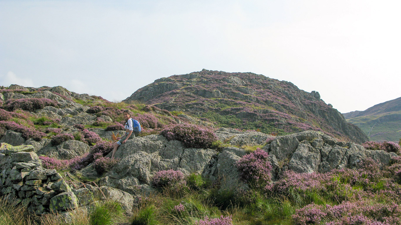
Stunning heather . . . behind Mila is the summit of Lingmoor Fell . . . where we’ll be heading shortly.

Pal exploring Side Pike and enjoying the views.

Hidden amongst the boulders and grass we saw a lizard – could be a common lizard?

Spectacular precipices which could make this area dangerous in foggy conditions but today the weather is absolutely perfect.

We’ll head up there soon . . . but first for The Squeeze.

Mila’s the first through The Squeeze . . .


Followed by me . . .

. . . and finally . . .

. . . Pal, and we’re all through The Squeeze.

The Squeeze . . . with Pike o’ Blisco beyond.

You wouldn’t want to take a wrong turn around here!

After exploring Side Pike we follow the stone wall up Lingmoor Fell.

We’ll follow the faint path alongside the stone wall before we cross it to visit Lingmoor Tarn.

Looking back to Side Pike.

Side Pike on the left and the Langdale Pikes beyond on the right.

Pike o’ Blisco; Crinkle Crags and Side Pike on the right.

Higher now and another look back at Side Pike.

The views are just so beautiful aren’t they . . .

. . . even higher now and looking back . . .

Looking west – Blake Rigg (with Blea Tarn at it’s base) leading to Pike o’ Blisco.

The Band leading to Bowfell to the left of Side Pike with the Langdale Pikes on the right.

Mila’s obviously feeling the heat now . . there’s no obvious path through the thick luxuriant purple heather but it feels beautifully bouncy underfoot.

Heading over towards Lingmoor Tarn.

. . . isn’t this incredible . . .

. . . and suddenly there’s Lingmoor Tarn cradled amongst the heather of the fell.

The cairn that you could see below marks the spot . . . with the spectacular backdrop of the Langdale Pikes.

A panorama of the scene . . . so beautiful!

. . . yikes . . . there’s more of the flies . . .

Heading up through the heather towards the summit.

Almost at the summit now.

Looking back down on Lingmoor Tarn with the Helvellyn range beyond.

Lingmoor Tarn.

Heading up . . .

Chapel Stile below, Silver How and the Eastern Fells. There are a number of old quarries in the area which have extracted slater from the side of Lingmoor over the years. You can barely see Yew Crag quarry in the distance, directly above the tip of the cairn in the photo.

Surprisingly quiet . . . allows for time to just enjoy the unspoilt vista.

Having climbed Lingmoor Fell it’s the perfect spot to have a lunch break!

The wall continues along the summit ridge.

Mila . . . I think that’s Pal’s walking pole . . .

From here you can see the Coniston Fells in the background . . . with Wetherlam on the left; then Swirl How and Great Carrs.

There are more walkers on the summit plateau.

Looking north to east . . .

There’s Loughrigg Fell ahead and Lake Windermere in the distance.

Mila waiting for us at the stile as we begin our descent.

There’s Swirl How and Great Carrs sweeping around and down Wetside Edge. The dark grey fell in the far distance is Harter Fell with Blake Rigg in front and Cold Pike the dark fell just peaking up above on the far right.

Further west, left to right: Cold Pike; Pike o’ Blisco; Crinkle Crags; part of Scafell just to the left of Bowfell which is at the top of The Band; Esk Pike; Great End; with Allen Crags behind Rossett Pike.

. . . heading down.

The heather seems to be at its very best at this time of the year.

It’s down all the way now . . .

This is a great circular route with superb views the whole time.

Taking a quick look back to the summit through the small cluster of trees.

One of our many stops to sit back and enjoy the views.

Looking back along our route today, down Lingmoor Fell and Side Pike with the Langdale Pikes in the background.

A last look back at Lingmoor Fell.

Looking right along the Mickleden Valley.

You can see the path we followed earlier in the day around Blea Tarn . . . a very worthwhile addition to the walk today.

Through the bracken and we’re almost back down to the road.

There’s the road below us, from here we’ll turn left and follow the road back to the carpark.

Baa aah . . .

Mila leading the way . . .

Mila still looking chipper . . . almost back to the car now.

A trip to Ambleside to round off the day and look at the grey clouds now . . . This is White Platts recreation ground with St Mary’s church on the left.

There’s Wansfell and Wansfell Pike in the distance . . .

. . . But what we’re really ready for is tea and stickies at a great cafe in Ambleside . . .

Another wonderful day in the Lake District!