A linear walk planned for today starting at Honister Slate Mine climbing the three summits of Dale Head, Hindscarth and Robinson, ending in Buttermere returning to Honister by bus following a route I saw on Roger and Ann Hiley’s great website Loweswatercam.co.uk
WAINWRIGHT BOOK: The North Western Fells Book 6
DIFFICULTY: 3 WALK LENGTH: 7.2 miles (5hrs 41mins) including lots of rests and lunch stop.
DATE and START TIME: Tuesday 15th August 2017 Start time 10.45pm – Finish time 4.27pm
PARKING: Honister Slate Mine / Honister YHA National Trust car park, free for NT members (NY 228 137)
ROUTE WALKED: Honister NT YHA car park – DALE HEAD – HINDSCARTH – ROBINSON – Buttermere – refreshments at Croft House Farm Cafe then No.77 Keswick bus back to Honister Youth Hostel (£2.60 each and £1.80 for Mila).
WALK DETAILS: 7.2 miles(though our planned walk was only 5.3 miles and we didn’t even get lost), 5hrs 41 mins, ascent 3784ft.
HIGHEST POINT: Dale Head – 754m/2,473ft.
WALKED WITH: Pal and Mila (aged 14).
WEATHER: Torrential rain to begin with, then a mixture of heavy rain showers and sunfish spells – the weather improving as the walk progressed.
We waited in the car for a bit avoiding a heavy shower – hoping that was the last of the rain – but not long after we started walking it poured down again. I thought we might have to abandon the walk . . . luckily we didn’t and ended up having a superb walk.

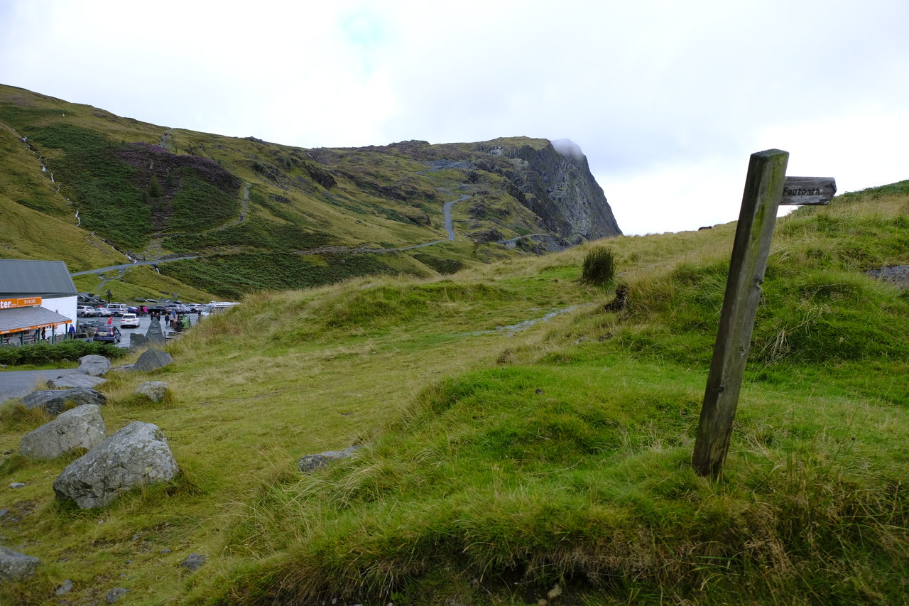
Walking up to the main road we turned left, just past the entrance for Honister Slate Mine and on the right there’s a sign post for the footpath.

This is where we turned off the road.

From here we simply followed the fairly steep path alongside the fence up to Dale Head. (Fleetwith Pike is seen in the centre of the photograph).
Mila is ready for anything . . . Mmh should we go on the right of the fence or the left? . . . . It doesn’t really matter as you can cross on to the right side (so the fence will be on your left) later on if you don’t do it now . . .

The view looking across to Fleetwith Pike with Honister Crag below.
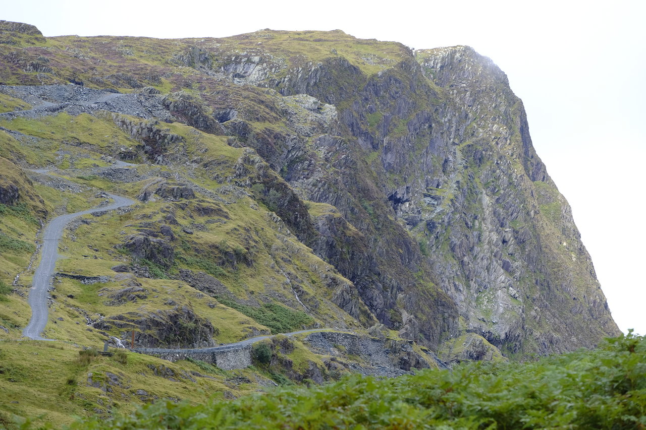
There’s the Old Tramway which leads to Drum House. It’s along this route that the bus takes visitors to the mine tour and Via Ferrata. (Via Ferrata – Honister Slate Mine) Via Ferrata (‘Iron Way’) it is described as ‘using a series of rungs, ladders and bridges along the old Victorian Miners track to the top of Fleetwith Pike. It gives the sensation of being exposed on a rock face, but with the addition of a continuous cable!’
View down to Honister Slate Mine, with Grey Knotts the fell on the other side of the valley.
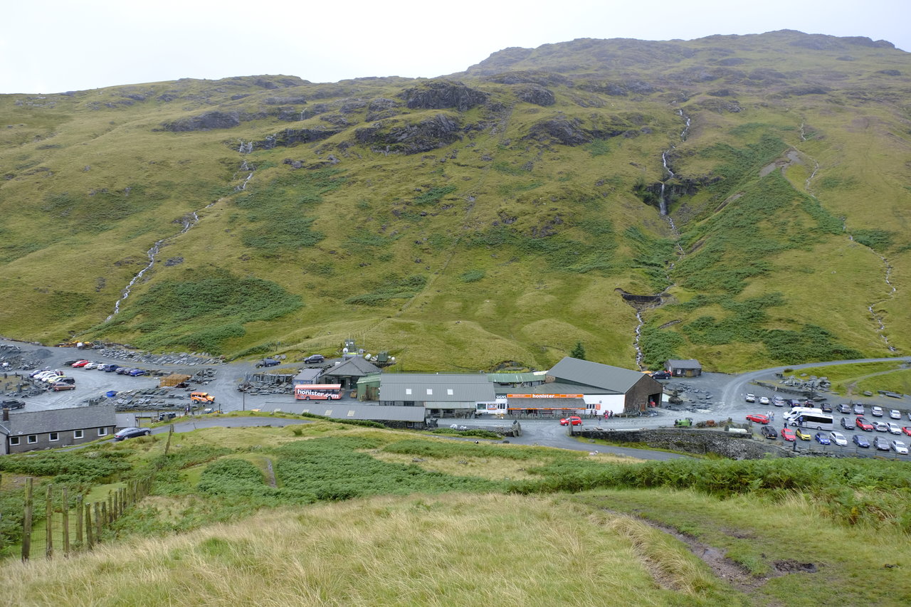
You can see the YHA building on the left of the photo where we left the car.

There’s the rain and it looks like it’s coming our way.

Up we go following the fence line, nice and easy.

We were still hopeful at this point that we would miss out on the rain but it was definitely heading this way – quite dramatic and very wet!

Mila taking a breather before we crossed the stile here and continued walking up on the other side of the fence.

Quite steep but an easy path to follow. Now with the fence on our left the summit isn’t that much further.

Up and up we go . . .

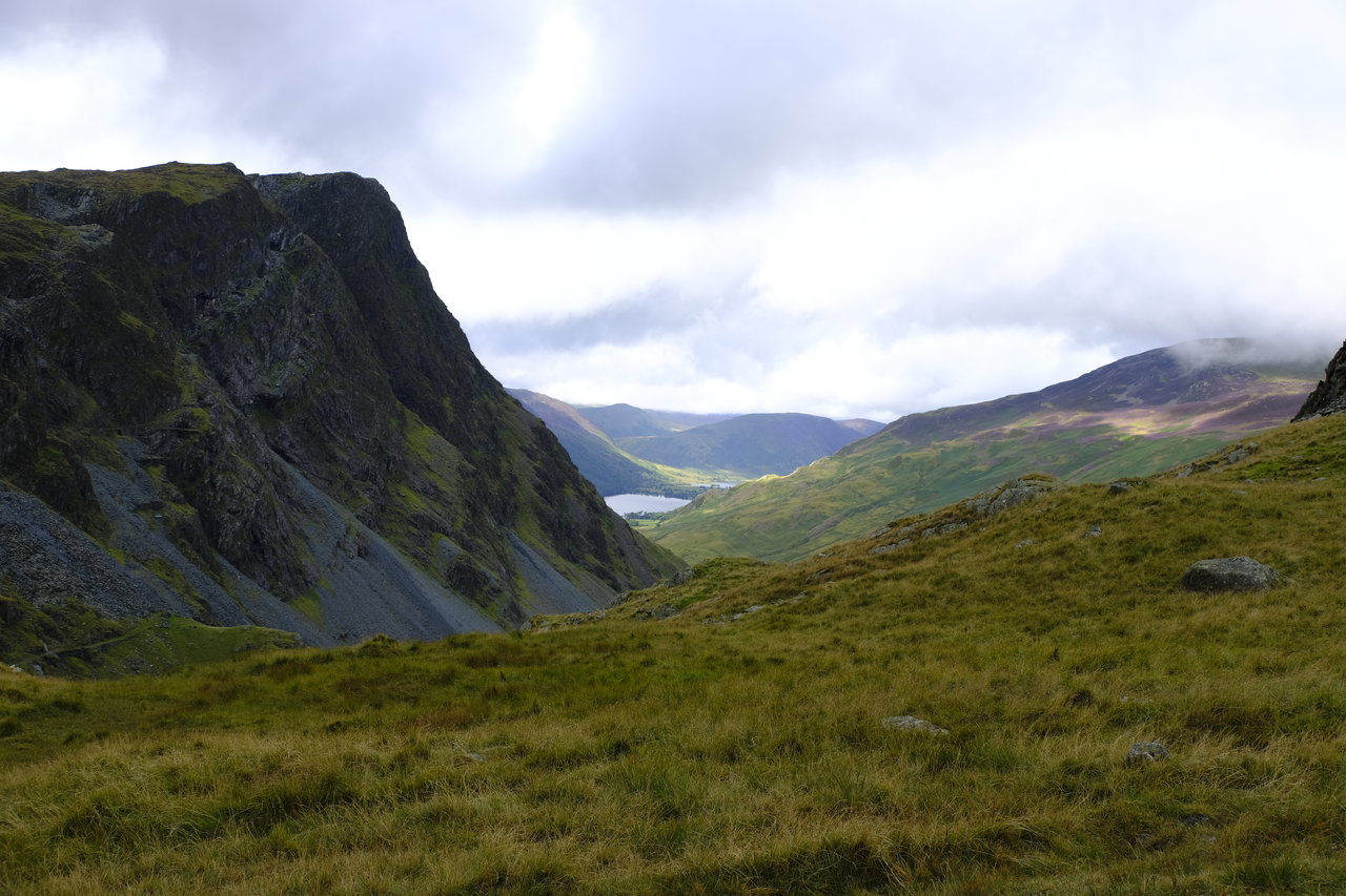
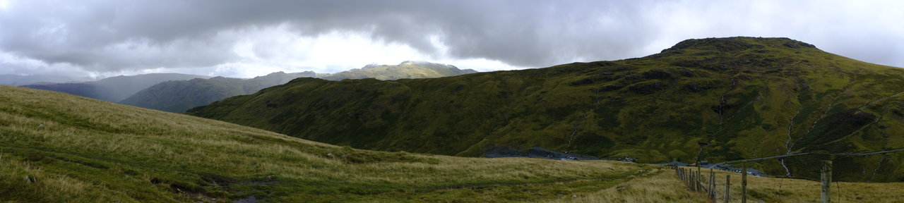
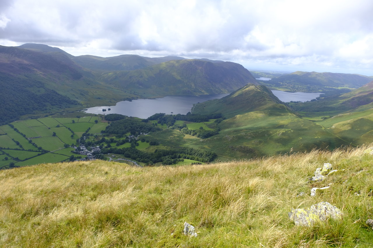
Fleetwith Pike on the left, Buttermere and Crummock Water with MELLBREAK beyond, Hen Comb is the triangular peaked fell just beyond Mellbreak on the left of it and Robinson on the right (taken from the route up from Honister Slate Mine to Dale Head).
A panorama from the slopes of Dale Head.

The view looking back the clouds adding drama to the scene and with them a lot of rain coming this way!

A close up of the same fells.
Which include (right to left): Bessyboot; Glaramara; Bowfell; Esk Pike, (with Allen Crags in front), then Great End. In front is the ridge leading to Grey Knotts?

Amazing views with the threatening clouds adding drama to the scene.
The weather was soon to catch up with us. . . .

We got absolutely soaked and I thought at this point that it would probably be best to abandon the walk once we reached the summit of Dale Head.

We made it up to the summit but the views were non-existent.

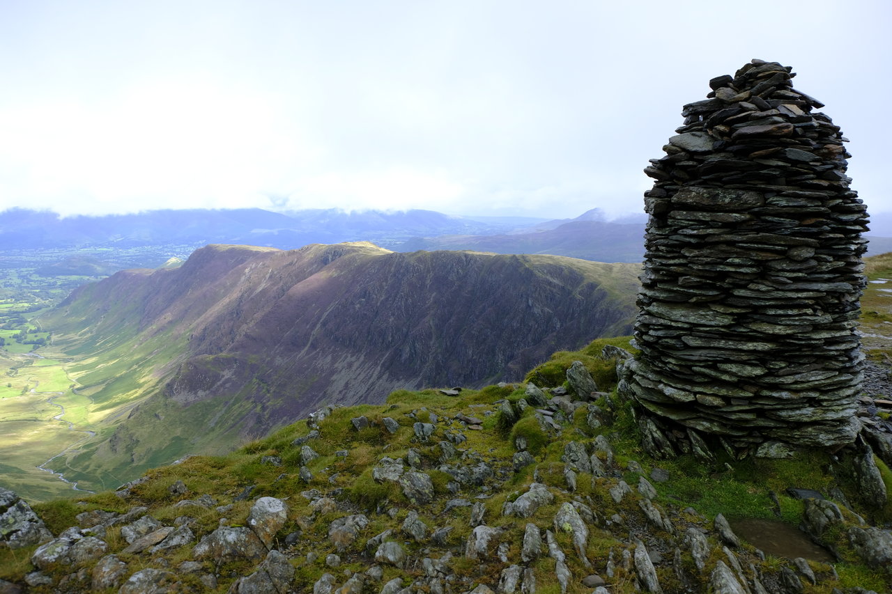
That didn’t stop our feeling of achievement as we arrived at the impressive summit cairn on Dale Head.

A let up of the rain and it’s a photo opportunity as Pal takes out his phone to capture the scene, or lack of scene!

Then, like magic the mist rose exposing the most enticing of views and as we watched the landscape became clearer and clearer and our short steep walk was rewarded with the most incredible panorama.

Mila wasn’t too happy when I said she couldn’t sit on that rock sticking out below – it was a pretty sheer drop down! It was still raining at this point but the improved views made it all worth while.

Eerie and mysterious like a magic trick unfolding before our eyes as Newlands Valley emerges from the gloom.

This makes me think of some arty film where the main character walks into the unknown. It was so amazing as the mist and rain lifted and the vista opened out around us.

Hard to believe how the view was emerging. There’s High Spy behind Mila with Bleaberry Fell the darker fells to the right of Mila’s shoulder and Clough Head and Great Dodd beyond.

Mila looking rather determined . . . I wonder what’s on her mind? To the right of Newlands Valley is High Spy and the ridge route down to Maiden Moor and Catbells. On the left of the valley is Scope End (the ridge leading to Hindscarth) and in front Rowling End leading to Causey Pike just visible (top left below cloud).

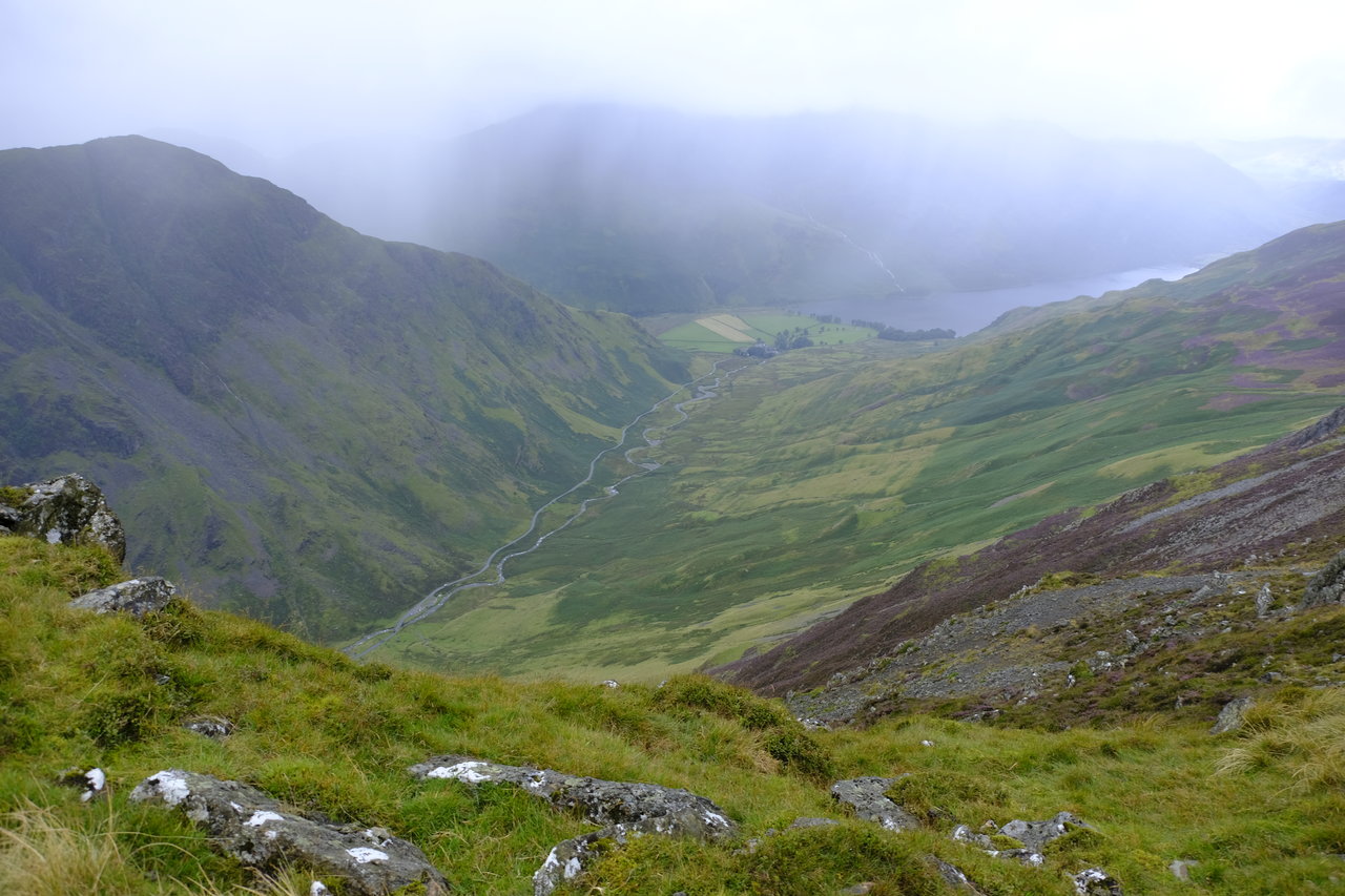
But in the other direction the view was almost completely hidden . . . just a hint of the route that lay ahead of us.

Dale Head’s summit cairn in all its glory, with High Spy beyond. An impressive reward for a fairly short walk.

Wow! Such views are hard to beat.
Photograph taken from the summit of Dale Head. Looking north west to north. The Newlands Valley is laid out before us. On the immediate left of the photo is Hindscarth Crags, Hindscarth with the ridge leading to Scope End with Near Tongue Gill flowing down to Newlands Beck and Far Tongue Gill nearer to where I was standing. Beyond Hindscarth is Rowling End and the distinctive summit of Causey Pike with the ridge leading to Scar Crags and between it and Hindscarth you have Ard Crags. In the far distance you can see a glimpse of Bassenthwaite Lake (behind Rowling End). On the far right of the photo is Eel Crags which form the slopes of High Spy.

I got a bit carried away with taking photographs but as the scene emerged from the murky mist it was just so beautiful.
Lovely shades of colour on the close up of Causey Pike. I’m not sure if it’s Lord’s Seat or Grisedale Pike behind it or something else entirely!

The ridge route would take us first to Hindscarth following Hindscarth Edge then to the fell beyond along Littledale Edge to Robinson.

There’s Hindscarth with Robinson beyond.

The path to Hindscarth was easy to follow with the views constantly improving.

There’s sunshine on Robinson, our final fell of the day.

The craggy side of Fleetwith Pike.

The Newlands Valley in all its glory.

Looking back to the summit of Dale Head. There are other walkers now, standing beside the summit cairn.

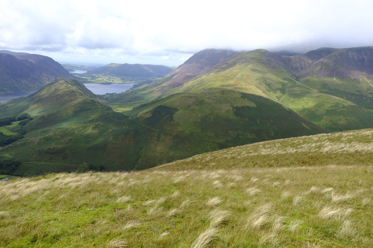
The view ahead to the second and third summits of the day, Hindscarth and Robinson.

Wainwright (Hindscarth 10) tells us that ‘Hindscarth and Robinson are lateral spurs emerging from the main fenced ridge of the north wall of Gatesgarthdale.’

Looking down on Crummock Water, you can see the rain . . . but as the views improved the rain wasn’t really a problem as we were well kitted out.

A clearly defined route the whole way.

The road from Honister to Buttermere – the Honister Pass with Gatesgarth Beck meandering alongside.
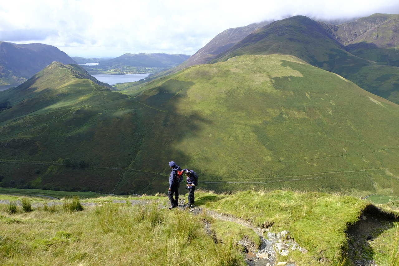
Heading westwards, there are intermittent fenceposts on the left. We’re heading for the first rocky rise on the Hindscarth ridge. Beyond the large cairn ahead is a clear route across a depression to the ridge ahead, where a right-angled turn leaving the fence, leads over the gravelly top of Hindscarth for half a mile to the summit.

Looking back up to the cairn (not the summit cairn) on Dale Head.

Mila and Pal in the shelter on Hindscarth, it was still pouring but visibility had improved.

As Mila and Pal waited at the shelter I walked on to the other shelter at the far end of the fell. As there were two walkers already sheltering there I didn’t linger but the views were magnificent.


This is the view from the further shelter with the Northern Fells in the background, Keswick and Derwent Water.

Mila was not inclined to add to the walk by exploring the further shelter and chose to enjoy the scene from her vantage point.

Scope End in the centre, with its heathery crest, the ridge that leads up to Hindscarth if you are ascending from Newlands Church and the Newlands Valley with the Northern fells beyond. You can just about see Bassenthwaite lake on the left and Derwent Water on the right.

Another photo of Scope End but this time with High Snab Bank (the ridge route up to Robinson from Newlands Church) in view behind it, and Causey Pike beyond covered in a think carpet of heather.

How many photos are too many photos? I know, too many, but it just seemed impossible to truly capture the beauty, honestly!
A panoramic view of the Newlands Valley and Northern Fells beyond.

A close up of Catbells, Keswick and the Northern Fells beyond with the summit of Blencathra on the right lost in cloud.

This time it’s of Skelgill Bank leading to Catbells with the ridge route Maiden Moor. Beyond is Keswick and the Blencathra end of the Northern Fells.

A close up of heather covered Scope End, the ridge that leads to Hindscarth from Newlands.

The gravelly summit of Hindscarth.

I think Mila needs a little sustenance, what do you think?

It’s now on to Robinson. ‘A linking of two lateral spurs with Little Dale lying between the two summits. From Little Dale Edge seen in the photo it would have been interesting to have explored a bit with a little detour (100 yards) across the fence on the final slope of Robinson to inspect the curious formations of Hackney Holes and Robinson Crag.’ (Wainwright Robinson 9). Wainwright says to ‘watch out for the conspicuous end of a broken wall (which looks like a cairn from the road below) – this stands on the rim of the main hole’.

Looking back at Hindscarth from Robinson.

Heading towards the summit of Robinson.

Looking back towards Honister Slate Mine and the start or our walk.


The summit of Robinson is described by Wainwright as, ‘two low outcrops of rock run parallel across the summit, the width of a road apart, almost like natural kerbstone or parapets – the westerly is slightly the higher and has the main cairn. The ‘road’ between is surfaced with loose stones. The top of the fell is a broad plateau with nothing of interest and no hazards (Wainwright – Robinson 10)


This photo shows more clearly what Wainwright was describing. It does remind you of a road doesn’t it?

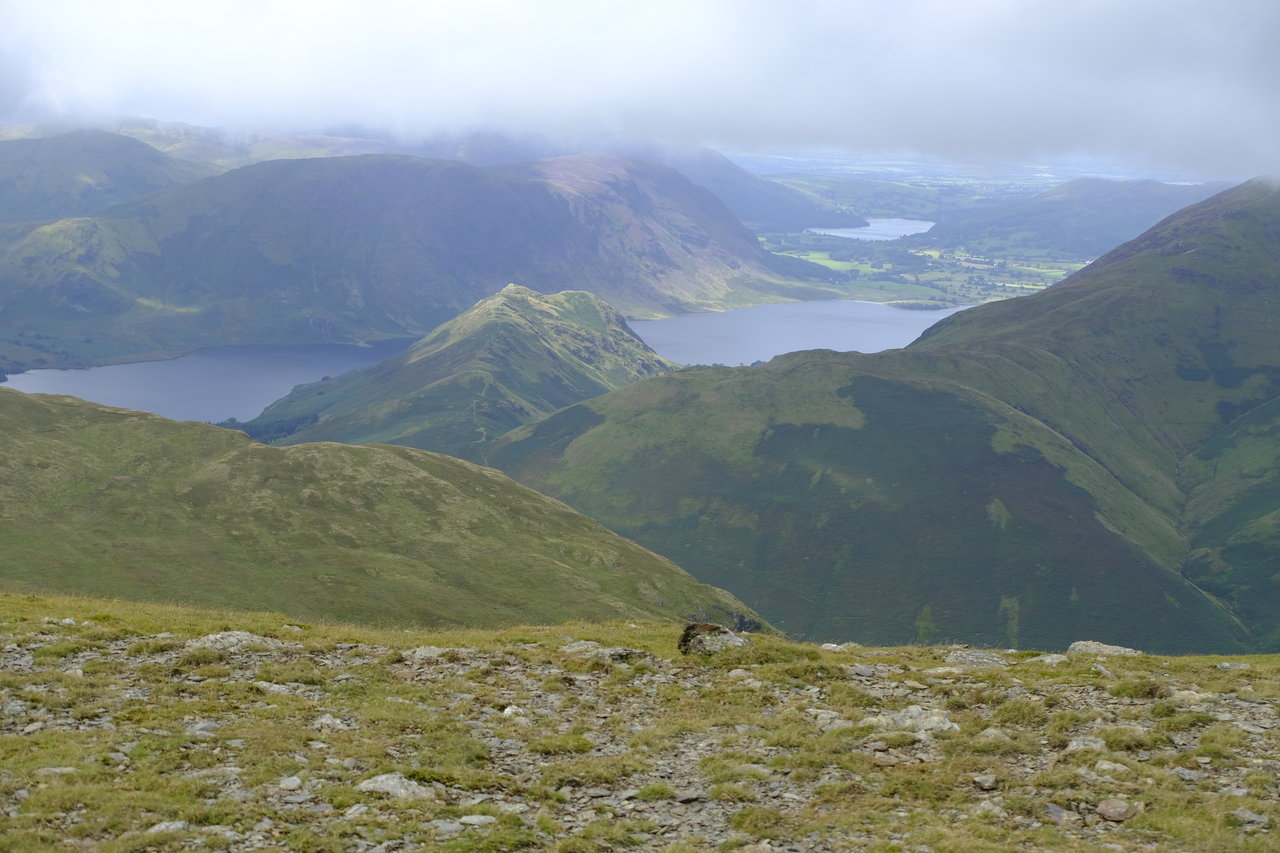
The view west from Robinson with Crummock Water and in the distance Loweswater (Buttermere is out of sight further round to the left of the photo).

Looking north with Ard Crags, Scar Crags behind leading along the ridge to Causey Pike and beyond to the Northern fells.

Further round to the east from left to right: Clough Head; Great Dodd; Stybarrow Dodd and in front Bleaberry Fell and High Seat with Fleetwith Pike in front.

Looking west. In the centre of the photo is Rannerdale Knotts with Mellbreak beyond. Behind Mellbreak on the left is Hen Comb and behind is Gavel Fell. On the right of Mellbreak is Blake Fell. On the right of Loweswater is Darling Fell and in front on the right is Whiteless Pike.
All three summits completed it’s now time to descend south east to Buttermere, heading for Buttermere Moss, incredibly boggy, well I suppose it’s to be expected when it’s called ‘Moss’!
 Mila’s well ahead as usual.

Across boggy Buttermere Moss and over High Snockrigg to find the path down to Buttermere.


Our first view of the village Buttermere, our destination, with Crummock Water and Loweswater beyond.
Buttermere lake.

Here you can see just how close Buttermere is to Crummock Water.

West to north, left to right: Rannerdale Knotts; Whiteless Pike with Grasmoor behind and on the right the slopes of Wandope.
Beyond left to right again: Mellbreak; Crummock Water with Loweswater beyond and Darling Fell.
It’s downhill all the way now.

In the valley there’s Sail Beck which becomes Mill Beck as it comes further down the valley. On the left is Whiteless Pike and beyond is Wandope and further right Eel Crag (Crag Hill); Sail; Scar Crags and the distinctive summit of Causey Pike. On the right of the photo is Knott Rigg leading along the ridge to Ard Crags.


It’s a steep path down and rather slippery because of all the rain.


Mila is after Pal’s sweets, to give her that bit of extra energy for the final leg of the journey!
Grasmoor on the left with Wandope the fell in front on the left with its slopes going down to Sail Beck. Eel Crag is at the head of the valley with Sail further to the right and then, on the right Ard Crags and Knott Rigg; taken from the route down from Robinson into Ambleside.

An enquiring look from an sheep. Is it a Southdown Norfolk sheep, known locally as “Blackfaces?


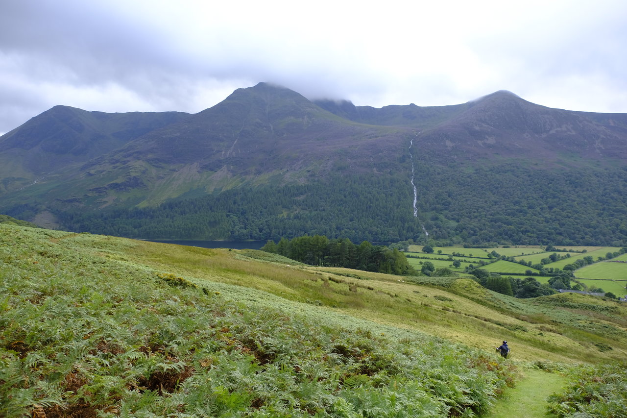
The waterfall is known as Sour Milk Gill (high up and out of sight is its origin, Bleaberry Tarn). On the left of Sour Milk Gill is High Stile and on the right is Red Pike (Buttermere).
A short walk along the road into the village of Buttermere.

 Under a window in the St James Church at Buttermere is a tablet inscribed with the words “Pause and remember Alfred Wainwright, who loved this valley. Lift your eyes to Haystacks, his favourite place.”


Time for a well earned drink and ice-cream at the cafe (Croft House Farm Cafe) near the bus stop, the perfect place to rest our weary legs while we wait for the bus.

On the bus back to Honister.

Views from the bus.

Haystacks and the famous Buttermere pines.


Finally, back to the car.


Despite the rain a fantastic walk, amazing views and well worth doing again.