An amazing day. Most people seem to do this walk in the other direction, but the ‘Collins Rambler’s Guide – Lake District’ (page 152) suggested this route, where we save Striding Edge for the descent. It says the scrambling is slightly easier in this direction, the views are even better, and towards the end of the day it becomes a little less crowded.’ And this really sums up the day – I would definitely do the walk in this direction again!
DIFFICULTY: 4 WALK LENGTH: Full day
DATE and START TIME: Saturday 9th August 2014 Start time around 7am
PARKING: Large pay and display carpark Glenridding. (NY385 169)
ROUTE WALKED: Glenridding – Greenside Mines – Red Tarn – Swirrral Edge – HELVELLYN summit – Gough Monument – Striding Edge – Hole in the Wall and back to Glenridding.
WALK DETAILS: c.7.5 miles, a very leisurely 8hrs 20mins. including lunch and coffee breaks.
HIGHEST POINT: Helvellyn – 950m/3118ft.
WALKED WITH: Pal and Mila (aged 11).
WEATHER: Very mixed! The day started cool and cloudy and rather overcast. Unfortunately on the summit it poured down and visibility on Striding Edge was very poor so we missed out on some great views . . . the weather then cleared and we had glorious weather once we got back to Glenridding.
As usual for me, we found the very start of the walk one of the most difficult! Pal and Mila, impatient to get started, me with the Garmin GPS unsure which way to go to begin with. Luckily the carpark was huge and virtually empty; there was only a couple of fell runners getting kitted up; so no obvious observers of me trying to get my bearings! In fact, once we got started it was fairly straight forward. Across Glenridding Bridge then right with Glenridding Beck on the right past the campsite on the left.
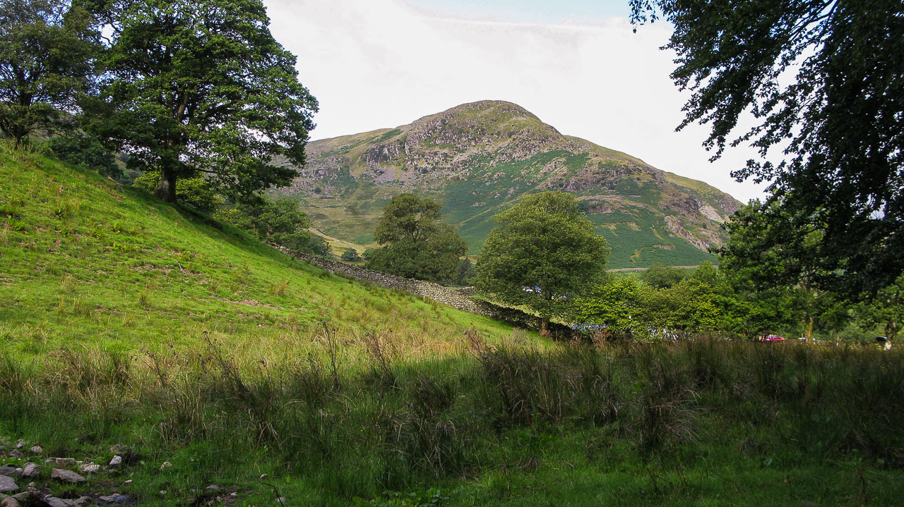
Below is a photo of Birkhouse Moor near the start of our walk.

We passed by some of the old Greenside mine buildings beside Swart Beck. Many of the buildings around the mine belong to climbing clubs and one is the Helvellyn
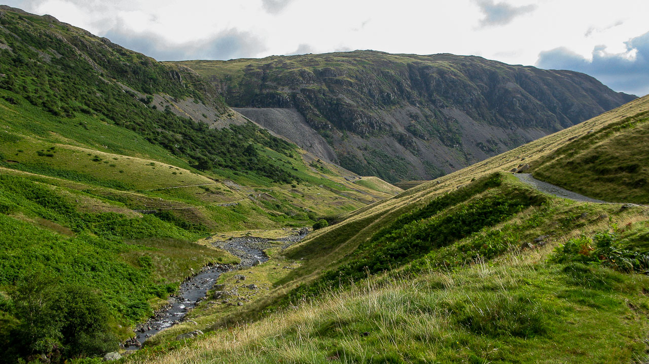
Youth Hostel. I’ve taken the following information from a great walking site: www.walklakes.co.uk – ‘Greenside Mine and Glenridding Beck Circular Stroll.’ In the past the mine produced over a million tons of galena which would be smelted into lead. In fact it was here that, during the Cold War, Operation Orpheus carried out two explosions to ascertain whether it was possible to obscure an underground nuclear explosion from being detected by the other signatories to the Test Ban Treaty.
Just follow the path . . .

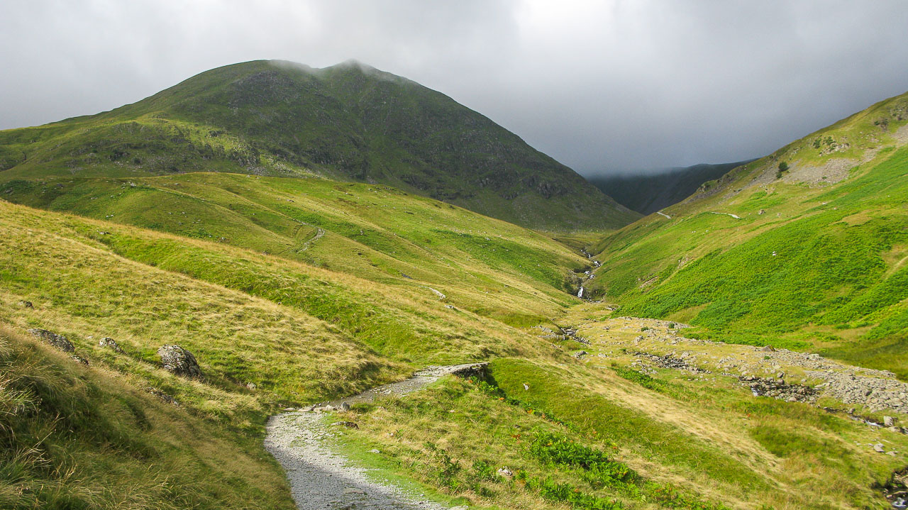
The path runs alongside Glenridding beck for a time.

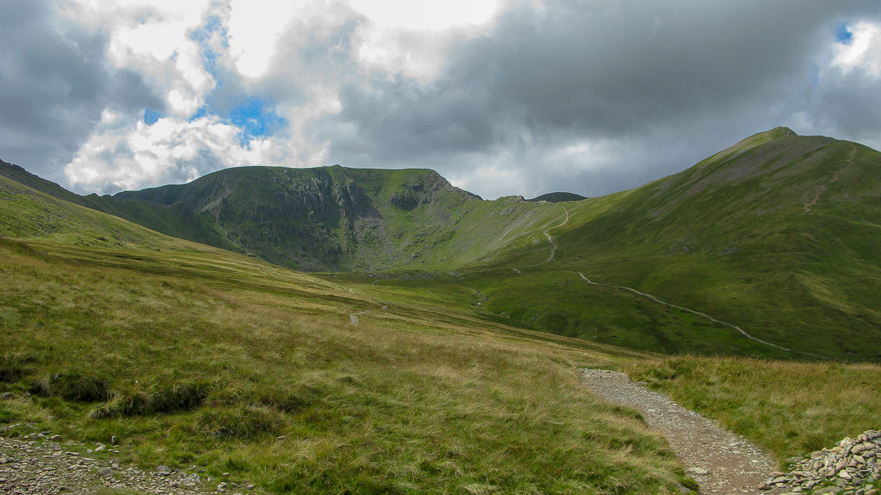
You can see the distinctive triangular summit of Catstycam (just in the cloud). It’s another Wainwright which we should have included in today’s walk but as we weren’t sure how tired we be at the end we decided to give it a miss this time. So we’re going to veer off to the left and omit it.

An easy path to follow . . .
 You can see Sheffield Pike over on the other side of the valley.
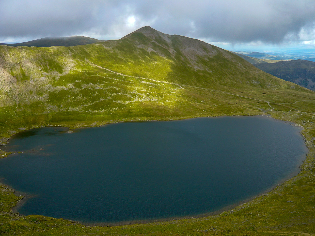
There’s Helvellyn ahead with Red Tarn out of view in front of it and Swirral Edge to the right and the start of Striding Edge on the left. We’ll be following the path you can see going up on the right, but as you can see the rain is coming with the descending clouds . . . unfortunately ruining our views from the summit.

The route we’ll take up Swirral Edge to the summit of Helvellyn.

Pal and Mila at the start of Swirral Edge, very quiet at this time of the morning and I think a better route up than doing the clockwise route up to Helvellyn via Sharp Edge which will be our route on descent.

Mila heading up the easy part of Swirral Edge with Red Tarn below.

The view opens up as we gain height with a clear view of Red Tarn at the base of Helvellyn – unfortunately the clouds were about to descend hiding any possible views from the summit.

Fabulous views . . . though it isn’t long before the clouds and rain hide it all!
 Despite the weather, Mila’s packet of ‘Monster Munch’ keeps her cheery as we have our lunch at the summit cross-shaped stone shelter – there was a real downpour at this point, so as you can see, visibility was very poor. Incredibly, while we were having our lunch two men with mountain bikes joined us. I can’t imagine anything trickier. They did admit having to carry their bikes for a lot of the way, definitely not my idea of fun! But very impressive non the less.

Pal smiling now the rain has started to ease up and he can enjoy his sandwiches without them getting wet! Though the rain seems to be easing visibility hasn’t improved and as we have still have Striding Edge to conquer we don’t hang about for too long!

This is all we could see of the summit views taken from the summit shelter . . . I suppose it just means that we’ll have to come up here again on a fine day.
 Anyway, lunch over and it was time to descend by Striding Edge, but this was the view that greeted us . . .
At times when the clouds cleared you could see down to Red Tarn. Mila had absolutely no fear and trotted along Striding Edge like a mountain goat, unlike me, who more or less kept to all fours, the rain had made the stones quite slippery, far from perfect conditions for a walk like this! Knowing that there are two memorials to those who have fallen doesn’t exactly ease my fears.

As we descended the clouds lifted and made us wish we’d rested for longer on the summit as the views would have been magnificent . . .
 Here, we’ve gone down the first section of Striding Edge.

An impressive look back, not a bad achievement.

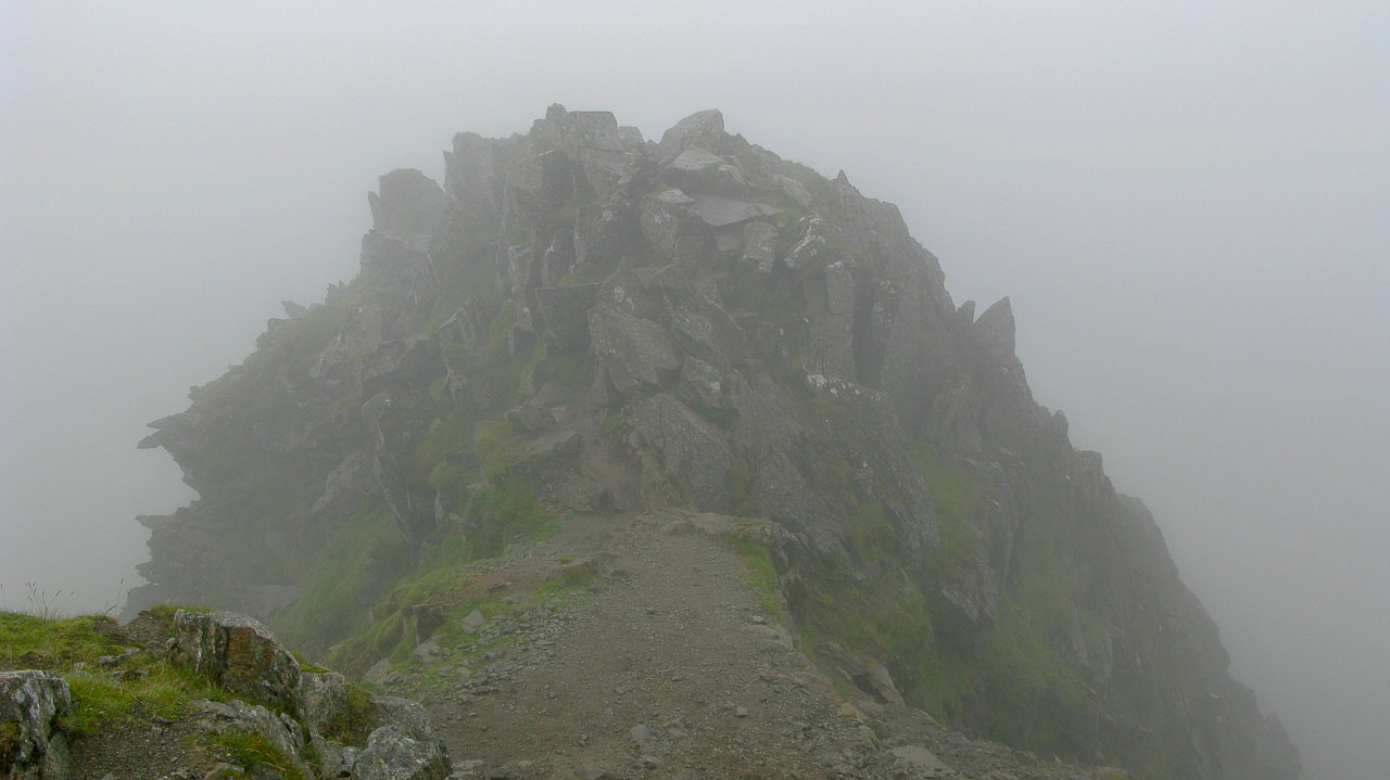
The path on this side avoids the crest, but we went over the top, the scary part . . .

Much busier on this side, Mila thrilled that she’s completed the tricky section of Sharp Edge.


The views are really opening up now!
 You can just see the summit shelter on Helvellyn. This photo doesn’t really show the scariness of Striding Edge, but you can see that there are a lot more walkers going up Striding edge than going down as we did, but I’m glad we did our route.
 Looking back at the route we’ve walked, with Catstycam on the right of the photo. You can see where we walked past Red Tarn and began our walking up Swirral Edge.

A close-up of Catstycam and our route up, it’s a real shame we didn’t include it and “bag” another Wainwright as I don’t think it would have added much distance to our walk . . . maybe next time!
The clouds rising revealing the summit of Hellvellyn and the impressive Striding Edge that we’ve just walked.
 A close up of the cross-shaped shelter on Helvellyn, quite busy with walkers now.

Wow, what a view. There’s Birdhouse Moor in the centre of the photo with Sheffield Pike and Heron Pike beyond. The darker fell in front of Birdhouse Moor is Gowbarrow Fell, Ullswater and Birk Fell and Place Fell further to the right.

Pal taking a moment to enjoy the views.

It just shows you how quickly the weather can change on the fells as Mila peels off one a couple of her layers which were so necessary on the summit.

Place Fell straight ahead.

Mila and Pal at the Hole on the Wall.

This is such a lovely photo of Mila I had to include it!

Helvellyn in all its glory. THere’s Catstycam on the right and our route up Swirral Edge leading onto the summit of Helvellyn with Striding edge on the left. I bet there are fantastic views from up there now . . .
Yes, we’re heading down there, back towards Glenridding, not far till we’re back at the car now.

‘Fell Bites’ cafe, right beside the car park in Glenridding. We’ve ended the day with glorious weather, what a fantastic day we’ve all had.
