Today we were heading for Loweswater to meet up with Roger and Ann Hiley and their dogs, Harry and Dylan. I met Roger a few years ago when he was working at George Fisher’s in Keswick and he spent hours helping me with my GPS and introduced me to his wonderful website, Loweswatercam.co.uk. Since then I’ve really enjoyed looking at their site, always great for inspiration as to where to walk and full of fascinating information as well as an insight into events in their lives. After contacting them on various occasions for extra help with my GPS they said to call them if we were ever in the area, we were and they very kindly invited us over. So today we were looking forward to catching up and maybe heading out for a local walk . . . we ended up with great company, a wonderful walk and way too many photographs!
WAINWRIGHT BOOK: The Western Fells Book 7
DIFFICULTY: 2 WALK LENGTH: Half a day
DATE and START TIME: Monday 15th August 2016 Start time 12.40pm
PARKING: The red letterbox, Thackthwaite, Cumbria. (NY148 235)
ROUTE WALKED: Thackthwaite – FELLBARROW – Watching Crag – LOW FELL– the viewpoint – Foulsyke and back to the Hileys.
WALK DETAILS: c.4.3 miles, though Roger records the walk as 5.1 miles, 3hrs 45mins including lunch.
HIGHEST POINT: Low Fell – 1387ft/423m.
WALKED WITH: Roger and Ann Hiley, their dogs Harry and Dylan, Pal and Mila (aged 13).
WEATHER: Another glorious summer day – Just perfect!
The ‘famous’ red phone box, now Loweswater’s emergency defibrillator and our parking space for today. There’s Hen Comb in the background.

First, a cup of tea and a chance to catch up and enjoy their wonderful garden with its incredible views of the surrounding fells.

Mila playing with Dylan and Harry, and a glimpse of Roger’s very impressive vegetable patch.

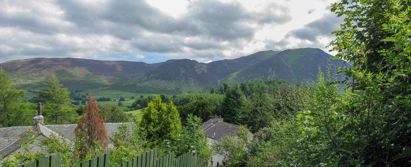
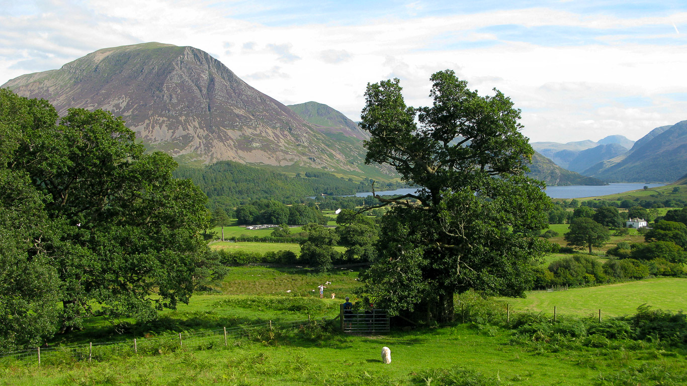
The view of Mellbreak from the Hiley’s garden.

This time a view of Low Fell from their garden!

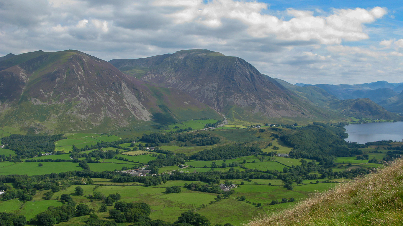
Roger and Ann chose a great walk for today which would enable us to bag another two Wainwrights and get some fantastic views of the fells around Loweswater. This is the gang (minus me, the photographer), Roger, Harry, Mila, Anne, Harry and Dylan at Thackthwaite Farm midway between Loweswater and Low Lorton (near where Roger parked up) at the start of our walk. We’re going to take the path up behind Pal. The track to Fellbarrow and Low Fell starts adjacent to Galloway Farm on the map.

It’s not long before the view start to really open up with the Vale of Lorton the heathery flanks of Swinside rise to form the main ridge at the top of Hopegill Head, passing over the subsidiary Ladyside Pike (formerly Lady’s Seat). Dodd is in the centre of the photograph with Hopegill Head (also known as Hobcarton Pike) being the green fell with the little pointy triangle with the ridge continuing to Whiteside.
Whiteside and Grasmoor. From the path we continue over the field.

From left to right here: Grisedale Pike; Ladyside Pike; Hopegill Head with the ridge leading to Whiteside.
The local farmer has been cutting back the bracken, not an easy job with such steep slopes. Here Mila and Pal open the kissing gate for Ann, Harry and Dylan.

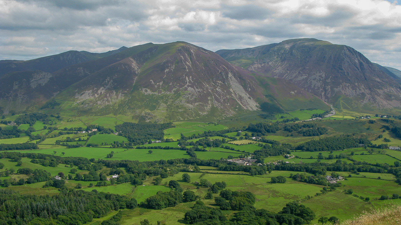
High Lorton with Graystones on the left then Broom Fell, further to the right the ‘bump’ on the horizon (with the grey fells of Skiddaw behind) is Lord’s Seat; Whinlatter Fell and the slopes of Swinside.

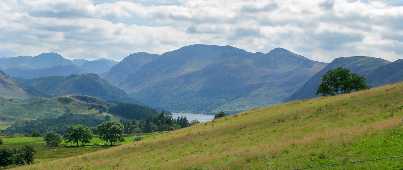
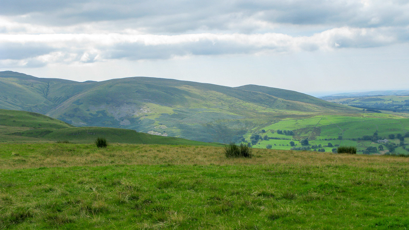
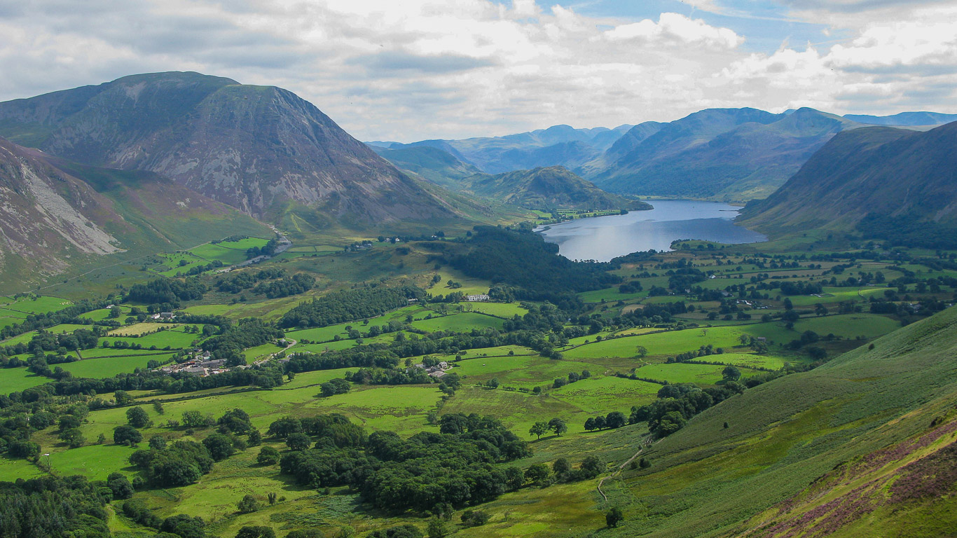
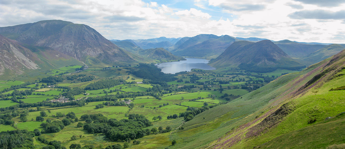
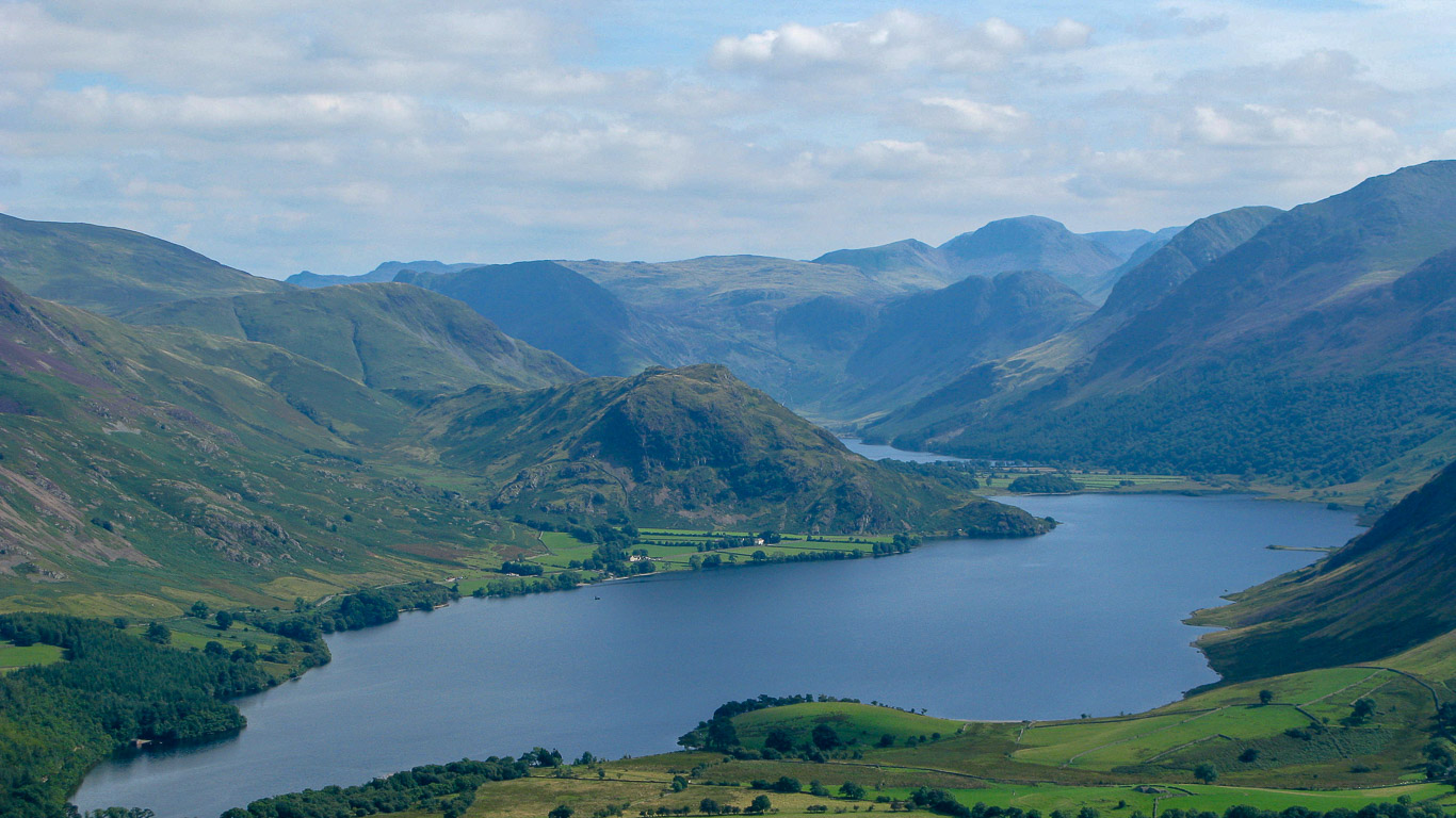
The views get better the higher we go. Across Crummock water the main fells (to the left of centre of the photograph) are High Crags; High Stile; Red Pike and Mellbreak.
From this photograph you get a better view of Whiteside and Grasmoor on the left and the path we’ve just walked up.

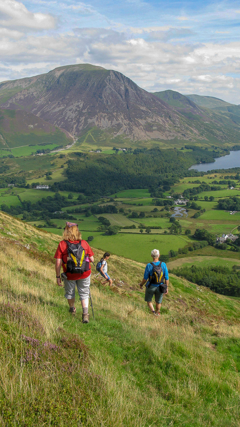
The grassy slopes of Fellbarrow ahead. While Ann and Harry will go on the direct route to Low Fell we will branch off and continue down towards the trees, there crossing the beck and following a faint path up past the line of larch trees.

Roger and Pal deep in conversation. Roger explains that the gate ahead is half-way round the curved path that climbs the short Meregill Valley and it is here that we need to turn and head for the first summit of the day, Fellbarrow.

It is near here that we leave Ann and Harry who turn left so that they can wait for us on Watching Crag on Low Fell as Harry now thirteen cannot walk as far as Dylan.

See you later Harry, Dylan seems to say . . .

Pal admiring the view down the valley and across to Lorton, Whinlatter and distant Skiddaw.

There’s Graystones ahead.

The problem with the faint paths at this time of the year is the waist high bracken.

Looking back at the route we have walked. Beyond the line of larch trees is Low Fell, where we’ll meet up with Ann and Dylan later on. Roger could see Ann and Harry at the top of the first zig-zag (which you can barely see on my photograph), but they’re invisible on mine!

A great view of the Northern Fells in the distance with Lord’s seat in front.

Mila and Dylan striding ahead.

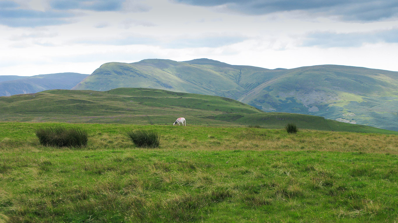
Dylan arrives first at the summit of Fellbarrow, closely followed by Mila. In the distance is is the Solway Firth, coastal waters that form part of the border between England (Cumbria) and Scotland and Criffel (a hill (570 metres high but appearing higher because of its isolation) in Dumfries and Galloway, south-west Scotland).

Dylan did get a bit of help from Roger to get up onto the Ordnance Survey Column! In the distance you can just see the wind turbines on the horizon.

Another photo of the summit trig point, this time with Roger too.
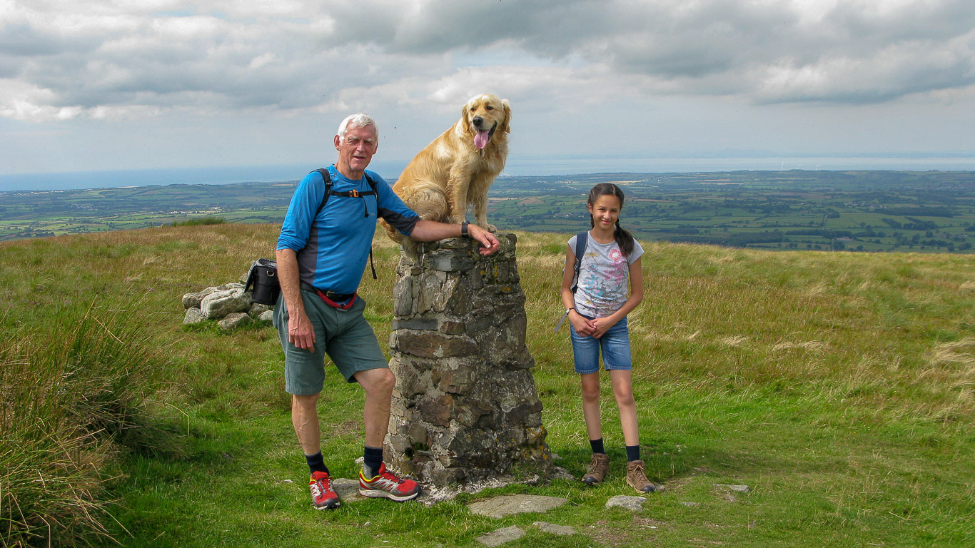
A family snap with Mila replacing Dylan!

Looking back at the route we’ve just walked.

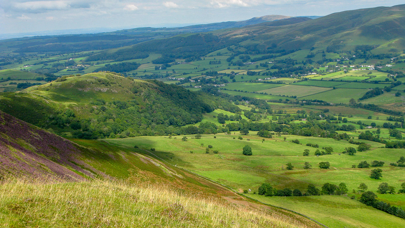
Looking south you can see part of Blake Fell and Burnbank Fell with Owsen Fell beyond, leading down to Whitehaven.
Further south the green fells are Carling Knott leading up to the summit of Blake Fell and then Burnbank on the right.

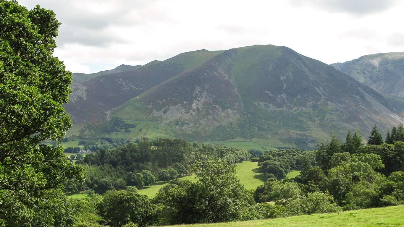
Looking back at Fellbarrow having crossed Smithy Fell and Sourfoot Fell and onto Low Fell where we will meet up with Ann and Harry on Watching Crag.

Beautiful colours . . .

Grasmoor now looms ahead.

Not far now . . . This collection of stones arranged in a ring about 60 yards west of the Ordnance Survey column doesn’t seem to have any special significance or history . . . I wonder what it was used for, a shelter or a sheep fold? Who knows.

Wow, isn’t ‘Watching Crag’ the perfect name for this spot where Ann and Harry have been waiting for us, and as we get nearer the views become even more spectacular! Dylan rushes ahead as he sees Ann and his trusted companion Harry and enthusiastically greets them both. Whiteside looms up this time (with Grasmoor just out of view on the right). The dark distinctive sharp peak of Hopegill Head is clearly visible to the left of Whiteside and Ladyside Pike is on the left of the photograph.

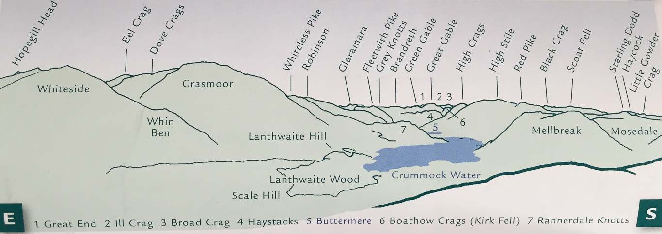
This is why ‘Watching Crag’ is the perfect name for this viewing point. Spectacular isn’t it! (Panorama taken from Mark Richard’s book, ‘Lakeland Fellranger – The Western Fell’ Cicerone 2011)

There’s Mellbreak straight ahead with its slopes going right down to Crummock Water.

Isn’t that a stunning view? Picture postcard I’d say!
Looking back at the route we’ve walked with Fellbarrow on the left; and straight ahead is Carling Knott, Blake Fell summit is no longer visible and Burnbank further to the right.

The Hileys: Ann, Roger and their gorgeous dogs, Harry and Dylan – Thanks for sharing this walk with us, it’s wonderful!

I thought I’d include the panorama again as it’s quite handy to have the panoramic view explained right beside the photograph itself. (Panorama taken from Mark Richard’s book, ‘Lakeland Fellranger – The Western Fell’ Cicerone 2011).
Each view is a little bit different and so beautiful that I just couldn’t work out which ones to omit so apologies to some for the sheer repetition but the views simply took my breath away!
Binsey is the fell on the horizon to the right of centre with the sun shining on it with Ling Fell in front of it and the slopes of Graystones rising on the right of the photograph. The wooded fell on the left is part of the Fellbarrow range (the northern most outpost) and is known as Hatteringill Head.
Lunch having been eaten it was time to continue on to the summit of Low Fell. Ahead is the last stile before the summit.

Looking north to east you have Binsey and Ling Fell then the gentle mound of Graystones, Broom Fell leading to the ‘bump’ that is Lord’s Seat with the Northern Fells beyond and the slopes of Swinside beyond the fields on the right.

The majestic fells of Whiteside, (and the triangular summit of Hopegill Head just showing to the left) and Grasmoor (with Dove Crags and Eel Crag behind).
An almost identical photograph to that above but this time showing Rannerdale Knotts and Crummock Water.
A more panoramic shot!

Ann, Mila and the dogs taking a little breather at the summit of Low Fell, rather demure compared to the incredible views. It feels like the cairn for the highest point on Low Fell should be a little more impressive . . .

Mila enjoying the company of Dylan.

Looking back to Fellbarrow not far away, with Watching Crag (Low Fell) to the right of centre, where the path is leading.

Onwards to the second cairn on Low Fell.

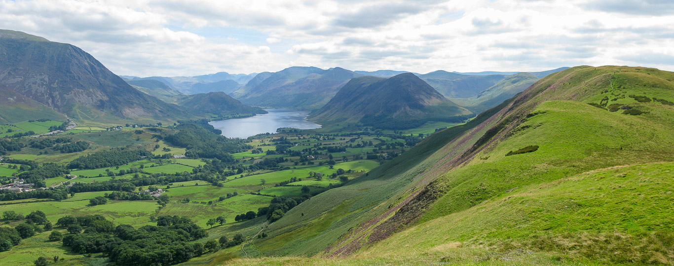
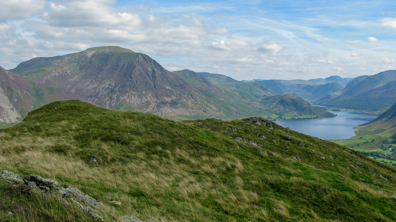
Left to right: lower slopes of Robinson leading onto High Snockrigg then down onto Rannerdale Knotts, jutting out into Crummock Water. In front of High Snockrigg you have the lower end of Whiteless Pike known as Whiteless Breast and in front of that you have the lower slopes of Grasmoor with Lanthwaite Wood at the bottom left hand of the photograph. The grey fell behind High Snockrigg (on the left) is Comb Head then after the dip it’s Glaramara. The darker fell in front is Fleetwith Pike then Brandreth; the triangular summit is Green Gable then Great Gable (with its more rounded summit. Then Broad Crag and Kirk Fell. High Crag on the right with its slopes going down to Buttermere (lake) followed by High Stile and the lower slopes of Red Pike. Finally, Haystacks is the fell to the right if centre directly in front of Great Gable.
Such a magnificent chocolate box view isn’t it? The pond you can just see near the bottom of the photograph is the wildlife pond at Godferhead.
A close up of Mellbreak.

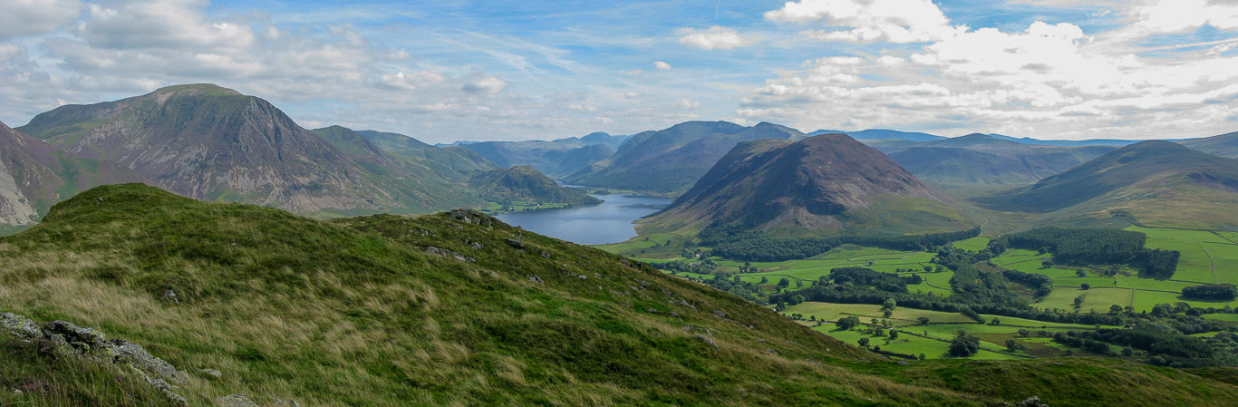
The summit of Low Fell is in the middle of the ridge, so the path continues on, undulating its way to the southern cairn and view point through the patches of purple heather along the way.

Just follow the path to the second cairn for yet more views.

Looking back . . .

Beautiful heather with Whiteside and Grasmoor just visible above.

Almost there now . . .

Skiddaw and Skiddaw Little Man on the far left then the slopes of Swinside with the bumpy ridge of Hobcarton End leading up to the triangular summit of Hopegill Head. (Ladyside Pike is in front, just to the left of Hopegill Head.

(Panorama taken from Mark Richard’s book, ‘Lakeland Fellranger – The Western Fell’ Cicerone 2011).


Mila, Roger and Pal at the southern cairn on Low Fell.

This time with Ann and a view of the surrounding fells.

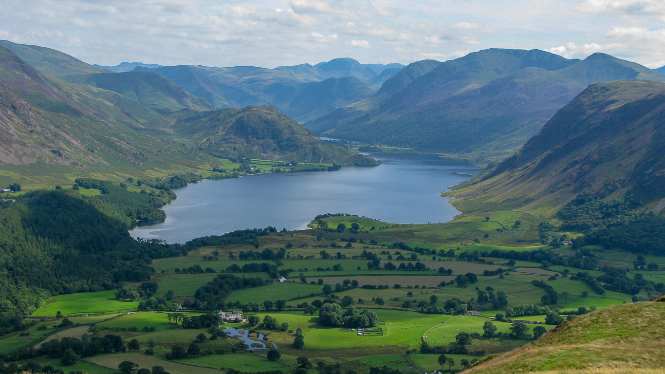
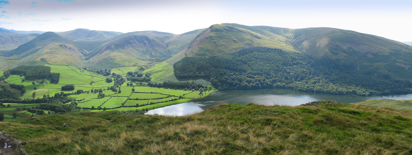
This time we have a view of Loweswater with the three prominent fells here being (I think): Hen Comb; Gavel Fell and Blake Fell with its long high shoulder, Carling Knott with Holme Wood at its base.
At the base of Carling Knott, the long high shoulder of Blake Fell, and Burnbank Fell to the right, is Holme Wood on the south side of Loweswater. Can you see the shape the woods have been planted in?
It’s in the shape of a crouching pheasant, the ‘Loweswater Pheasant’. It was deliberately planted as a shaped and coloured artwork many years ago. The bird’s eye, though hard to see in this photograph, is made up of a circular stand of larches. In autumn the yellowing larch leaves will be in high contrast with the dark green of the spruce and fir!
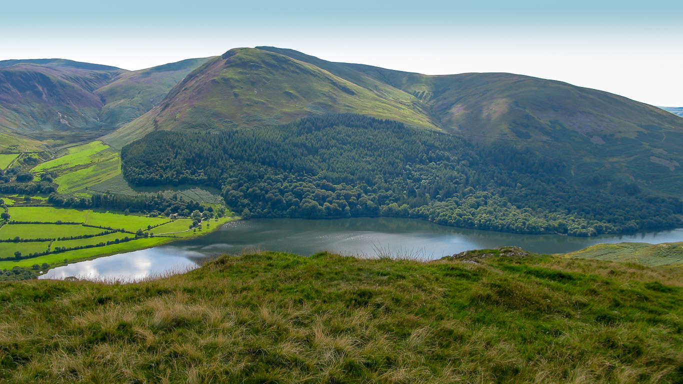
A panorama of the Loweswater Fells and the Loweswater Pheasant with the fells left to right being: Hen Comb; Gavel, Carling Knott which is part of Blake Fell round to Burnback Fell with Loweswater in front.
A group photo of Ann, Pal, Mila and Roger beside the southern cairn on Low Fell – I wonder where Ann and Mila are looking, hey, I’m over here where the boys are looking! Maybe Ann and Mila are just enjoying the views!

This time with Harry.

Beautiful views . . .
Mellbreak is in the centre with Hen Comb to its right.

A panorama of the same view.
Looking west to Darling Fell with Loweswater on the left.

Time to descend now . . .

. . . and yet one more photograph, this time including me!

A pretty steep descent with Roger descending at quite a speed. Fellbarrow our first summit of the day over on the right. 
A real closeup of Mellbreak, it almost looks like a painting.

Mila soaking up the views.

Mellbreak on the left and Hen Comb on the right.

Time for a quick breather . . .

Simply spectacular!

There’s no obvious path down much of this route and it’s pretty steep so takes a bit of concentration.

There’s Grasmoor ahead – and this photo gives an indication of the steepness of the gradient as we descend. You can also see the wildlife pond at Godferhead.
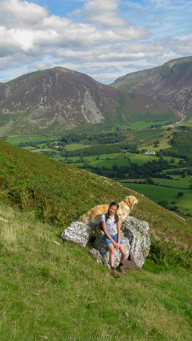
Dylan and Mila have found the perfect place to perch while they wait for us to catch up.

We’ve caught up . . .

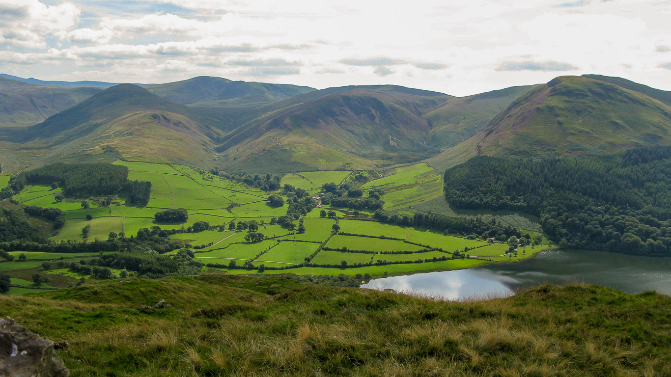
Not far till we’re back down to the valley. There’s the meandering wildlife pond of Godferhead and the group of white houses at Foulsyke.

Mila is picking up speed . . . I’m sure she was a fell-runner in a former life.

Beautiful yellow gorse and purple heather.

A look back as Pal and Ann head down through the bracken.

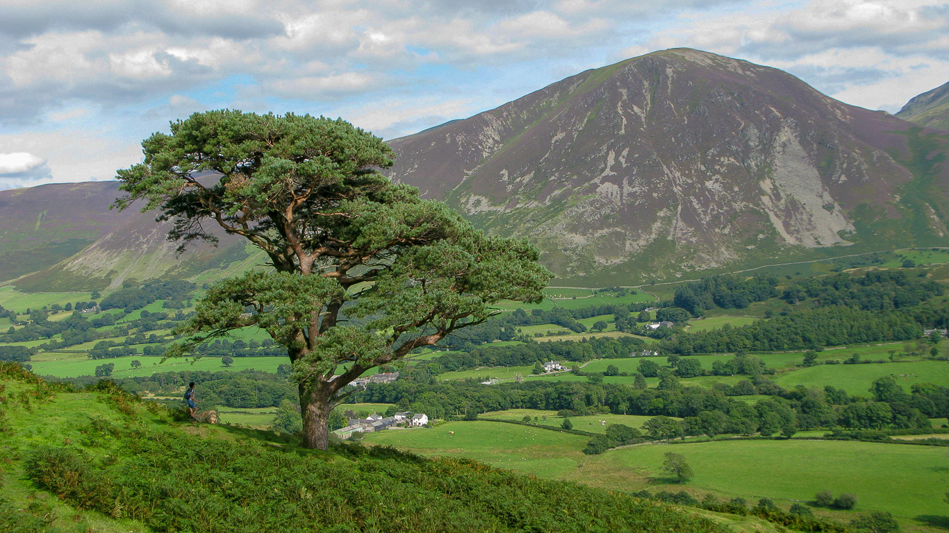
The picturesque old pine on the slopes of Low Fell, a great vantage point.

The old pine with a view towards Whiteside. Mila and Dylan are already there.
Down through the woods.

Through the gate, Mila and Dylan now well ahead, Harry plodding on, amazing energy for his age.
Not far till we’re back to the cottage now.

Looking back to Low Fell.

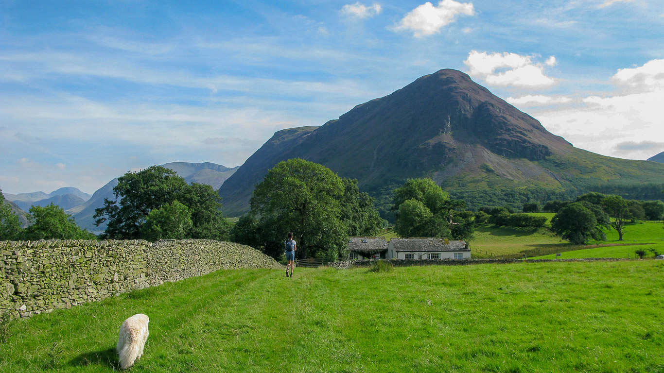
Just passing by Foulsyke.

Yes, that’s the footpath that we’re going to follow back to the Hiley’s cottage.

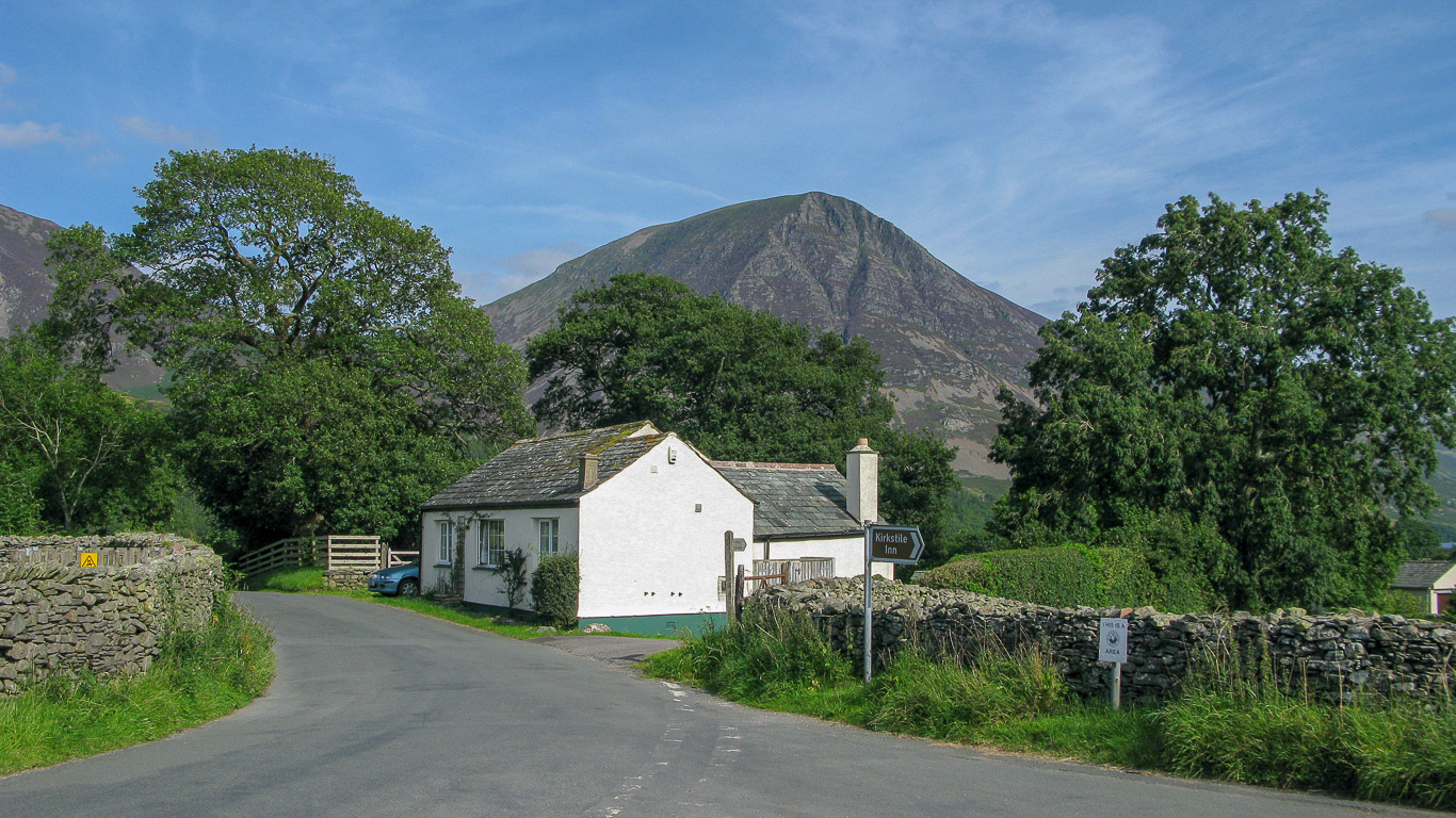
Foulsyke with its impressive backdrop of Low Fell.

This is the view that house above has . . . imagine waking up to a view like that.

The Hiley’s cottage ahead, they’ve got amazing views too haven’t they . . . behind their cottage is Mellbreak.
Time to take off our walking boots and enjoy a much needed cuppa with some of Ann’s delicious fruit cake.
That’s me, Mila, Roger and Ann enjoying the afternoon sunshine . . . a perfect day. Thank you Ann and Roger!
